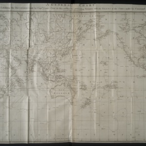
Global Map in A Voyage to the Pacific Ocean
Dublin Core
Title
Global Map in A Voyage to the Pacific Ocean
Creator
Jordan Erlendson
Date
1784
Rights Holder
Special Collections, University of Victoria
Rights
Special Collections, University of Victoria
Subject
Voyages around the world.
Oceania -- Discovery and exploartion
Pacific Coast (North America)
Northeast Passage
Clerke, Charles, 1741-1779
Gore, John, 1730?-1790
Oceania -- Discovery and exploartion
Pacific Coast (North America)
Northeast Passage
Clerke, Charles, 1741-1779
Gore, John, 1730?-1790
Description
Captain Cook's account of his voyage to find the "Northwest Passage" in the North Pacific. This is a global map that folds out. The biggest map in the books.
Source
Special Collections, University of Victoria: g420 c6 1784 v.1
Publisher
Published for H. Chamberlaine, W. Watson, Potts, Williams, Cross, Jackson, Moncrieffe, Walker, Jenkin, Burnet, Wison, Wogan, Exshaw, Vallance, Beatty, White, Whitestone, Burton, Byrne, Mills, J. Porter, Stewart, Wallace, Higly, Cash, Herry, Mc.Kenzie.
Contributor
JEE
Format
w090 X h060
Language
English
Type
Map
Date Created
November 17, 2017
Bibliographic Citation
Cook, James. A Voyage to the Pacific Ocean. Vol 1. Dublin, H. Chamberlaine, W. Watson, Potts, Williams, Cross, Jackson, Moncrieffe, Walker, Jenkin, Burnet, Wison, Wogan, Exshaw, Vallance, Beatty, White, Whitestone, Burton, Byrne, Mills, J. Porter, Stewart, Wallace, Higly, Cash, Herry, Mc.Kenzie, 1784, pp.1.
Files
Citation
Jordan Erlendson, “Global Map in A Voyage to the Pacific Ocean,” UVic Libraries Omeka Classic, accessed June 1, 2022, https://omeka.library.uvic.ca/items/show/1162.
Embed
Copy the code below into your web page

