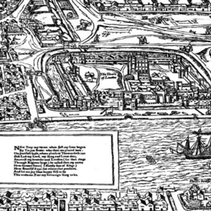
Agas Map depicting the Tower of London.
Dublin Core
Title
Agas Map depicting the Tower of London.
Creator
Ralph Agas
Date
1633
Rights Holder
Map of Early Modern London
Subject
Agas, Ralph, 1540-1621.
Early modern, 1500-1700.
Renaissance--England.
Early modern, 1500-1700.
Renaissance--England.
Description
Cropped image from the Agas Map from the Map of Early Modern London depicting the proximity of the Tower of London to the Thames.
Source
Map of Early Modern London
Publisher
Dr. Janelle Jenstad
Contributor
CT
Format
Still digital image. 2000x1124 pixels.
Language
English
Type
Map.
Date Created
5 December 2017
Bibliographic Citation
The Agas Map. The Map of Early Modern London. Ed. Janelle Jenstad, 2012, 27 July 2012, Rpt. of Civitas Londinvm, 1562, ,http://mapoflondon.uvic.ca/map.htm.
Files
Citation
Ralph Agas, “Agas Map depicting the Tower of London.,” UVic Libraries Omeka Classic, accessed June 1, 2022, https://omeka.library.uvic.ca/items/show/1493.
Embed
Copy the code below into your web page
